Project Gallery
Discover the visual impact of our GIS and Remote Sensing work through maps, analyses, and visualizations that tell compelling spatial stories.
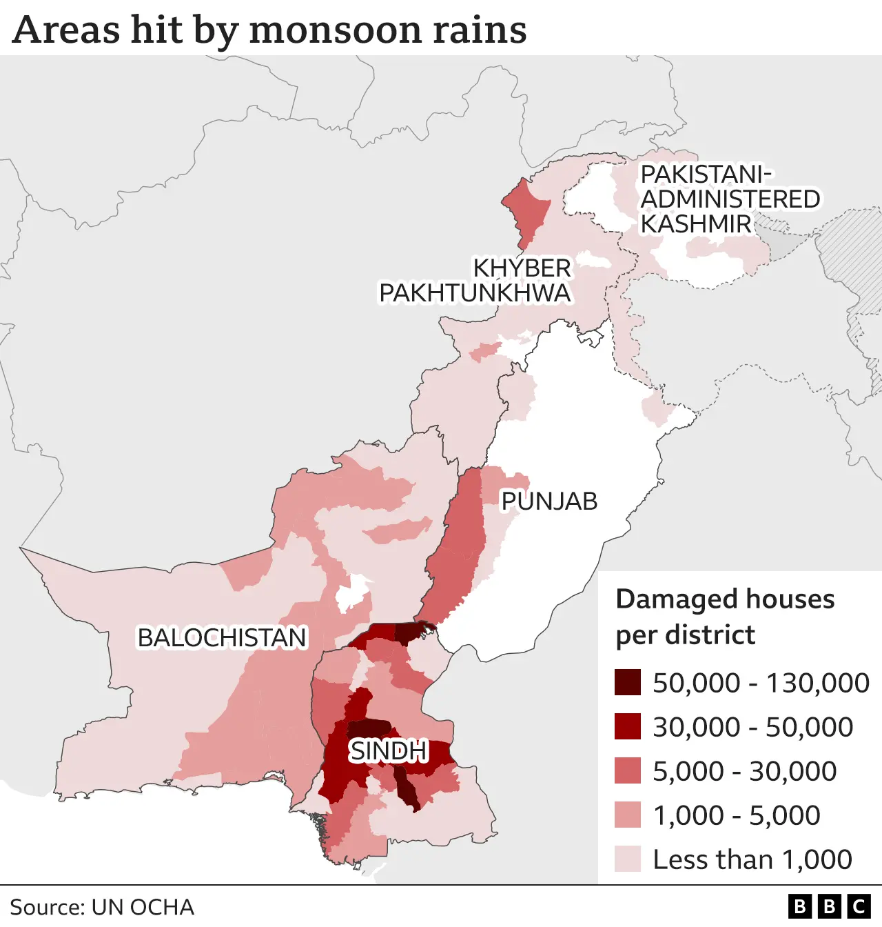
Disaster Management
Geospatial Damage Assessment
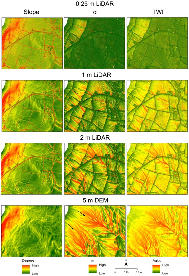
3D Mapping
Surface Modeling with LiDAR
Environmental
Urban Heat Island Mapping
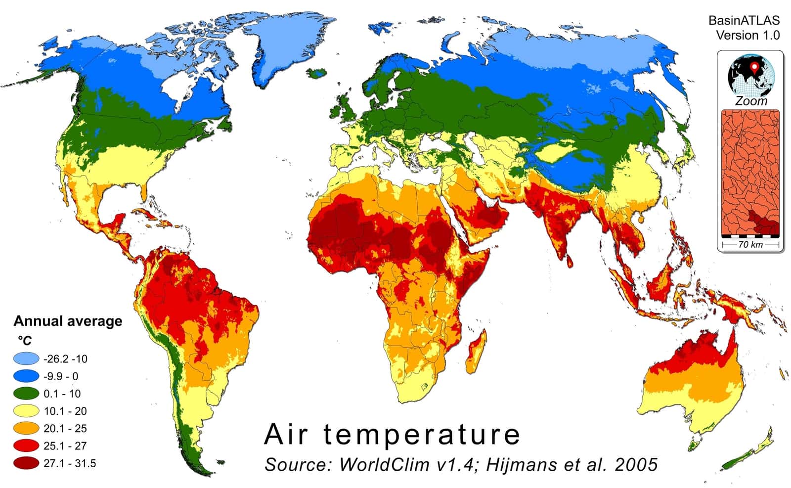
Enviormental
Air Temperature Analysis
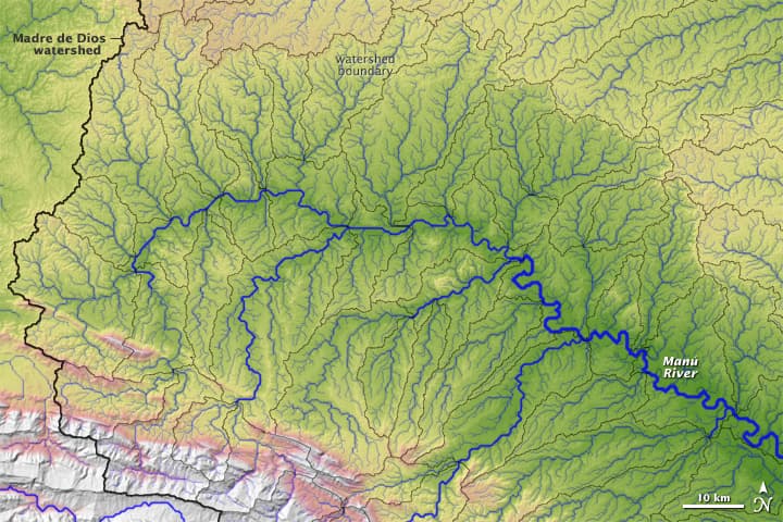
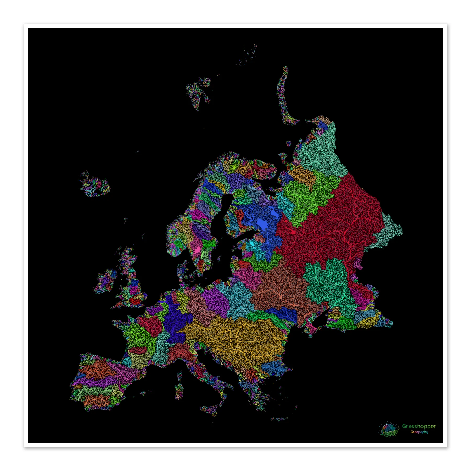
Hydrology Mapping
River Flow Visualization
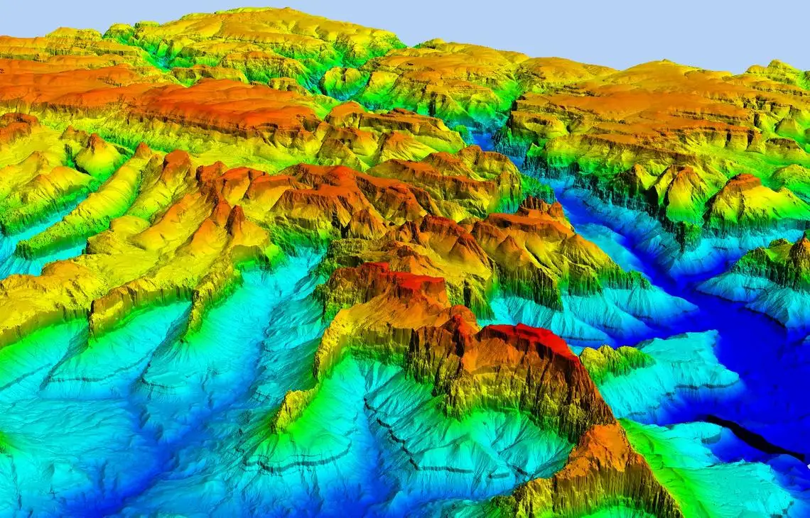
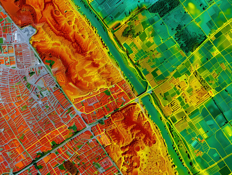
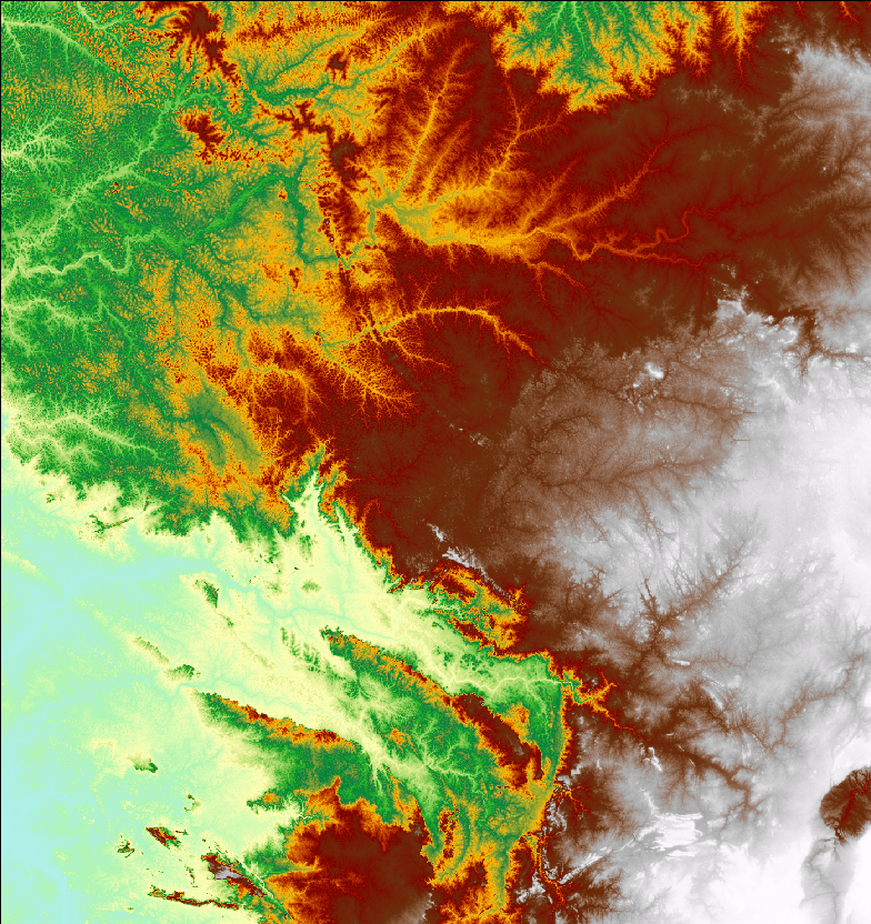
Terrain mapping
3D Terrain Modeling
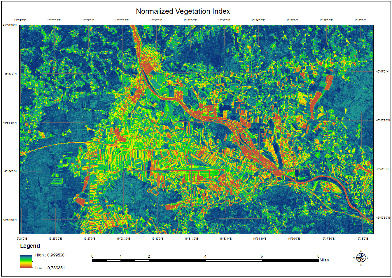
Agriculture Mapping
Normalized Difference Vegetation Index
Hyrdrology Mapping
Hydrological Analysis
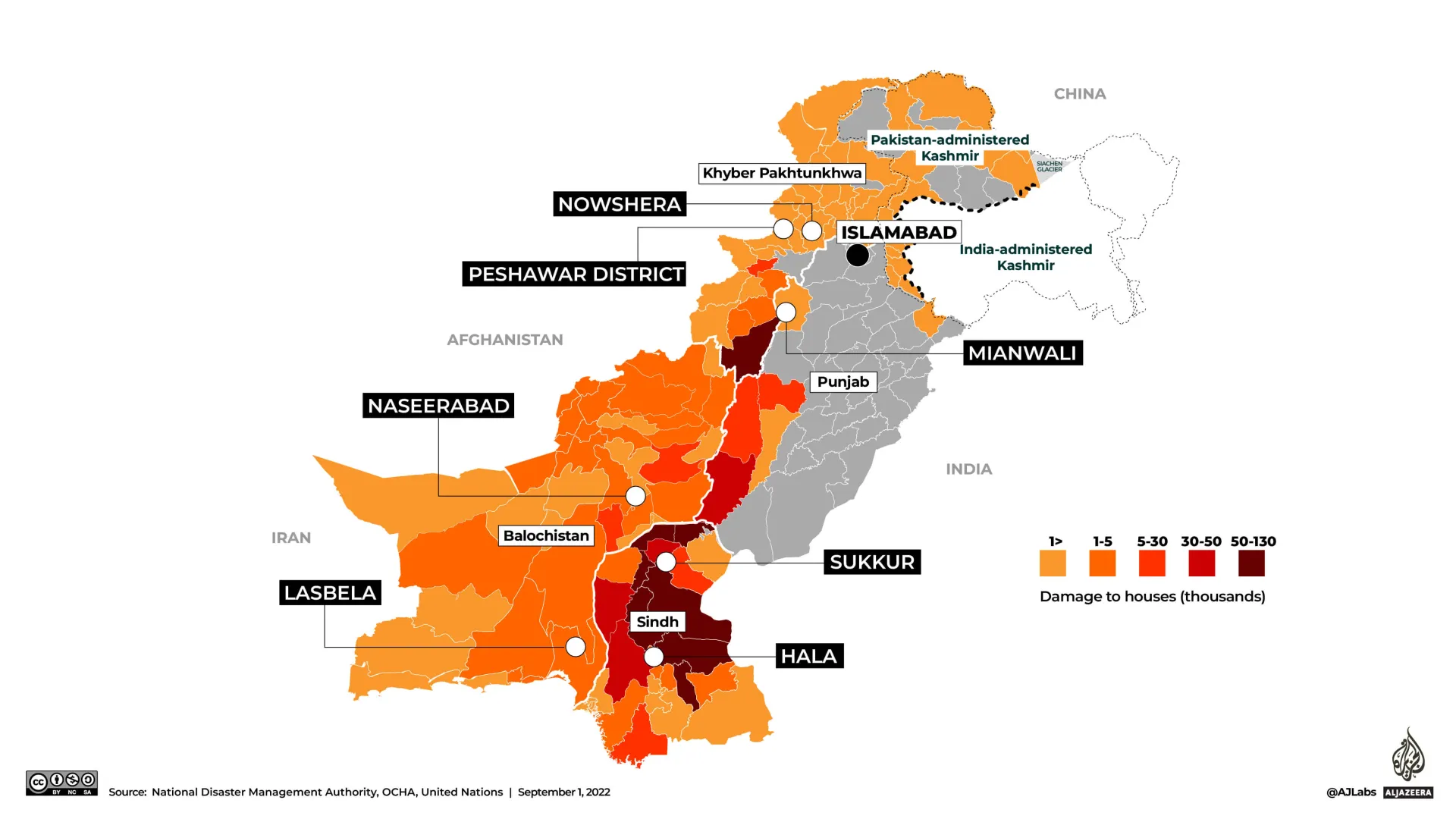
Disaster Mapping
2022 Flood House Damage Assessment
Topgraphic Mapping
Topographical Mapping of Europe
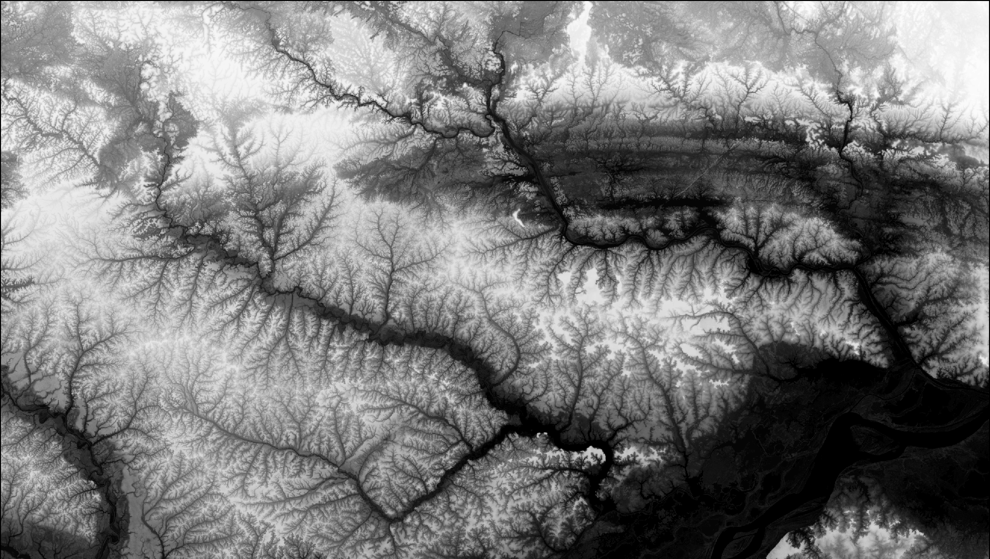
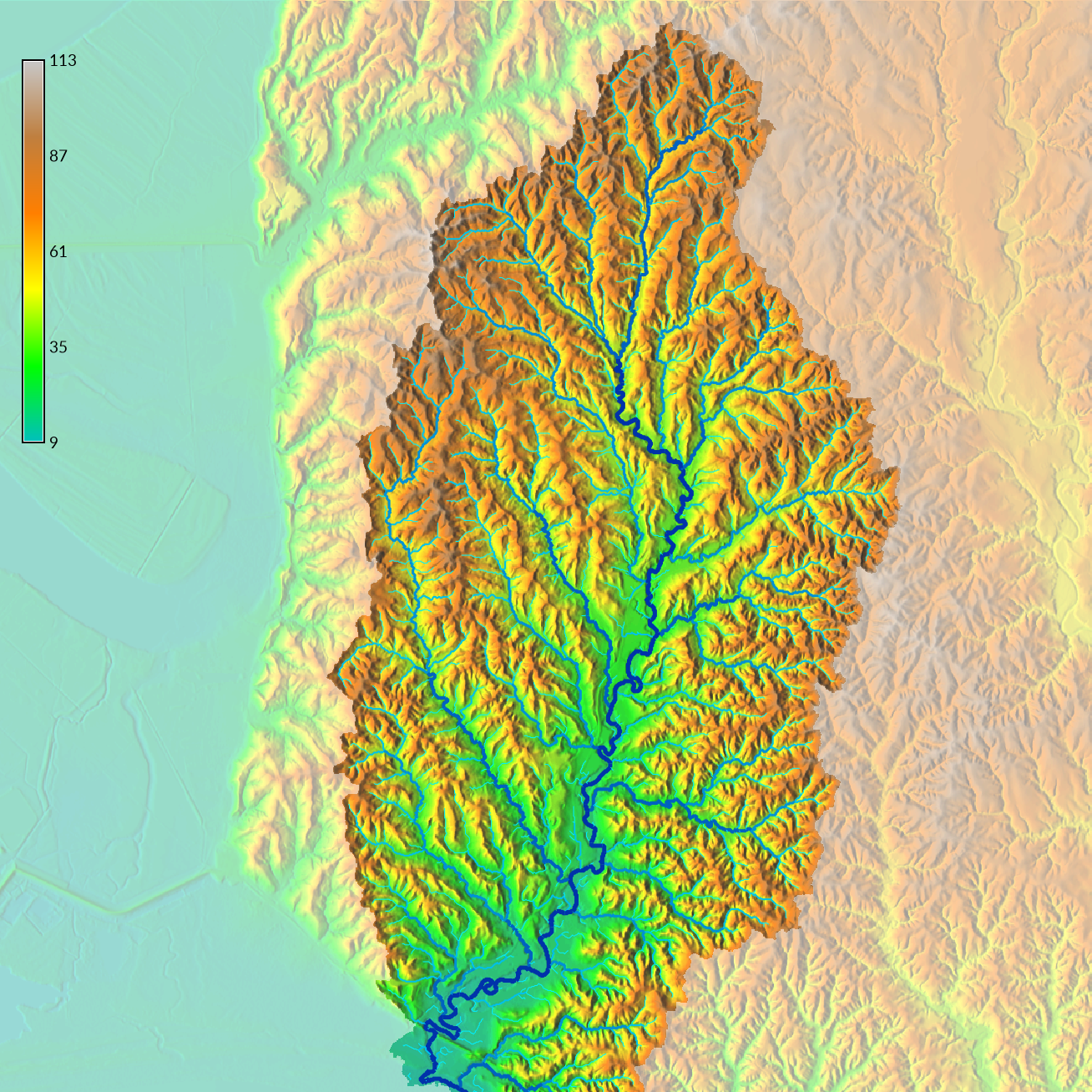
Elevation Mapping
Digital Elevation Model (DEM)
Elevation Mapping
Digital Surface Model (DSM)
Explore by Category
All
Remote Sensing
Environmental
Agriculture
Urban Planning
Disaster Management
3D Mapping